
Risk overview
Seven-day weather risk overview
Daily weather risk summary
|
|
|
|
|
|
|
|
|
|---|---|---|---|---|---|---|---|
| risk level |
|
|
|
|
|
|
|
What factors are driving the risk?
The graphic shows the weather factors that have some risk for the next 7 days. Click on the colored boxes to see what the risk factors is based on and what impact it may have.
| Fire Weather Risk |
|
|
Fire Weather Risk: risk level 0
|
Fire Weather Risk: risk level 0
|
Fire Weather Risk: risk level 0
|
Fire Weather Risk: risk level 0
|
Fire Weather Risk: risk level 0
|
|---|---|---|---|---|---|---|---|
| Frost/Freeze Risk |
|
|
Frost/Freeze Risk: risk level 0
|
Frost/Freeze Risk: risk level 0
|
Frost/Freeze Risk: risk level 0
|
Frost/Freeze Risk: risk level 0
|
Frost/Freeze Risk: risk level 0
|
No impact in 14 other categories: Severe Thunderstorm Risk, Tornado Risk, Thunderstorm Wind Risk, Hail Risk, Lightning Risk, Excessive Rainfall Risk, Extreme Heat Risk, Wind Risk, Fog Risk, Ice Accumulation Risk, Snow/Sleet Risk, Lakeshore Flood Risk, Marine Hazard Risk, Freezing Spray Risk
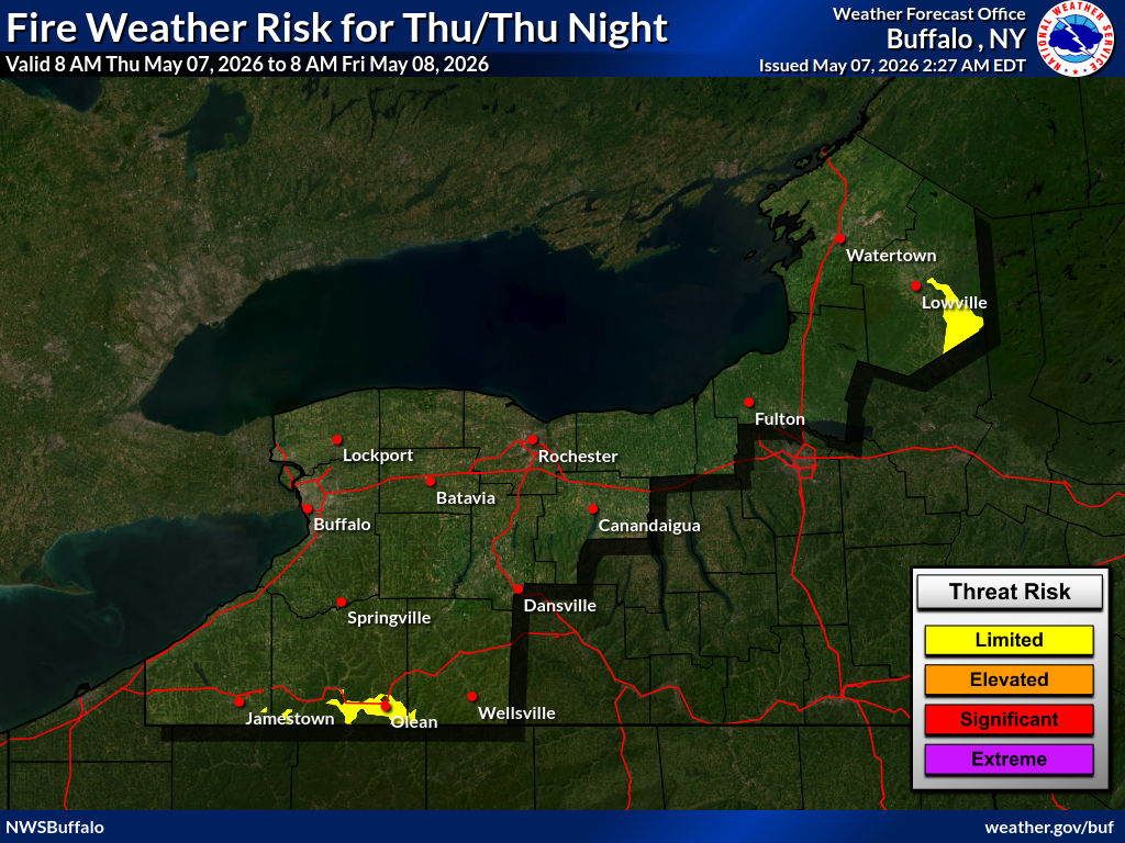
Monday: Fire Weather Risk
1: Limited
Open burning is usually safe with the proper precautions. Burning should be done in the early morning and late evening to avoid windier and drier conditions from midday through mid afternoon.
What is this based on?
We base this risk on local weather office forecasts of combined relative humidity, winds, and wind gusts.
Risk map
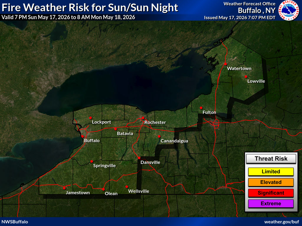
Risk levels
| risk level name | risk level description |
|---|---|
|
1:Limited
|
Open burning is usually safe with the proper precautions. Burning should be done in the early morning and late evening to avoid windier and drier conditions from midday through mid afternoon. |
|
2:Elevated
|
Any open burning is discouraged due to windy conditions and lower humidity. Fires can escape control more easily and be difficult to contain. |
|
3:Significant
|
Open burning should not be attempted. High winds and extended dry periods will produce extreme burning conditions. Open fires can quickly escape and are very difficult to control, even for experienced fire fighters. Conditions will exceed minimum Red Flag Criteria in most cases. |
|
4:Extreme
|
Very strong winds, combined with low humidity, will create extremely volatile conditions well in excess of Red Flag Criteria. Fires will spread very quickly with spot fires common. Fire control will be extremely difficult. |


Loading the risk data...